 69
69 If you are like me, practicing sports in a "freestyle" mode and far from civilization, this feature is made for you! Without any routes for sure, but with some preparation and planning notwithstanding. I am going to explain you how to empower yourself with downloadable maps on OpenTracks, so you will never get lost on mountain, on forest, or anywhere else.
Identify an approximative place to go
This weekend, I will be on the Mercantour, about to Saint-Martin-Vésubie. Many friends recommended it to me, and I think I am up for an altitude mission!
Open the app from your mobile phone, then click on « Download maps for offline mode » on the menu.
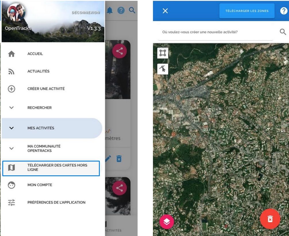
In that screen, select the map's areas you want to take with you. Thus, you are prepared to go to a spot without network, and you are precisely located on one or more maps you have downloaded beforehand.
Select the area
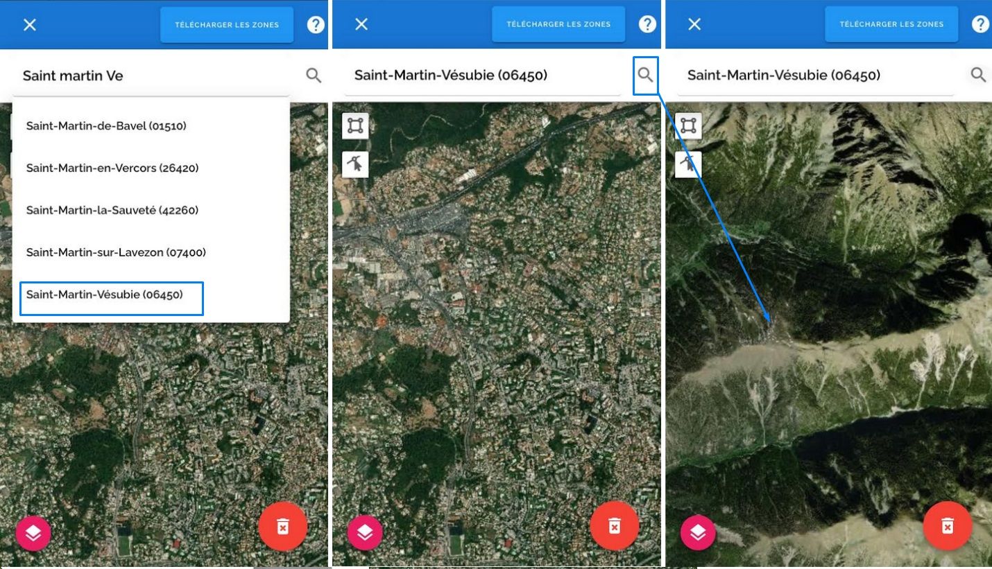
Introduction completed, let's download that map ! But how to do so? Nothing difficult: I enter the spot of my next expedition on the search field: "Saint Martin Vé..." then “Saint-Martin-Vésubie" appears automatically : wonderfull! I select it and the application focus directly above the city.
I change the map layout to see more easily the hiking routes, I choose Hiking & Biking with a click on the specific button.
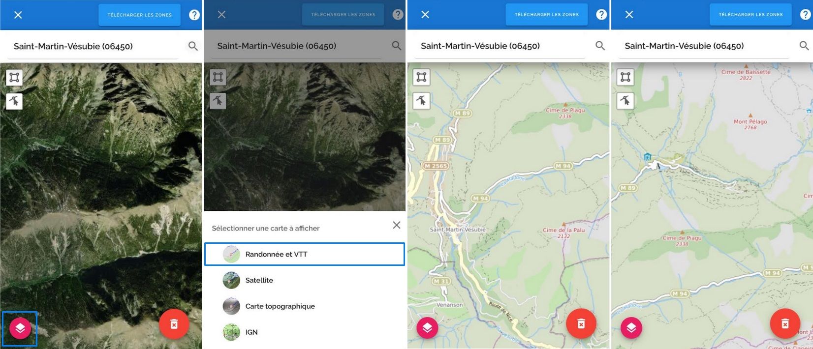
I move the map from right to left, zooming, unzooming, and I observe various tracks in that area. It is exactly what I expected : I will start to create a personalized map according to my needs.
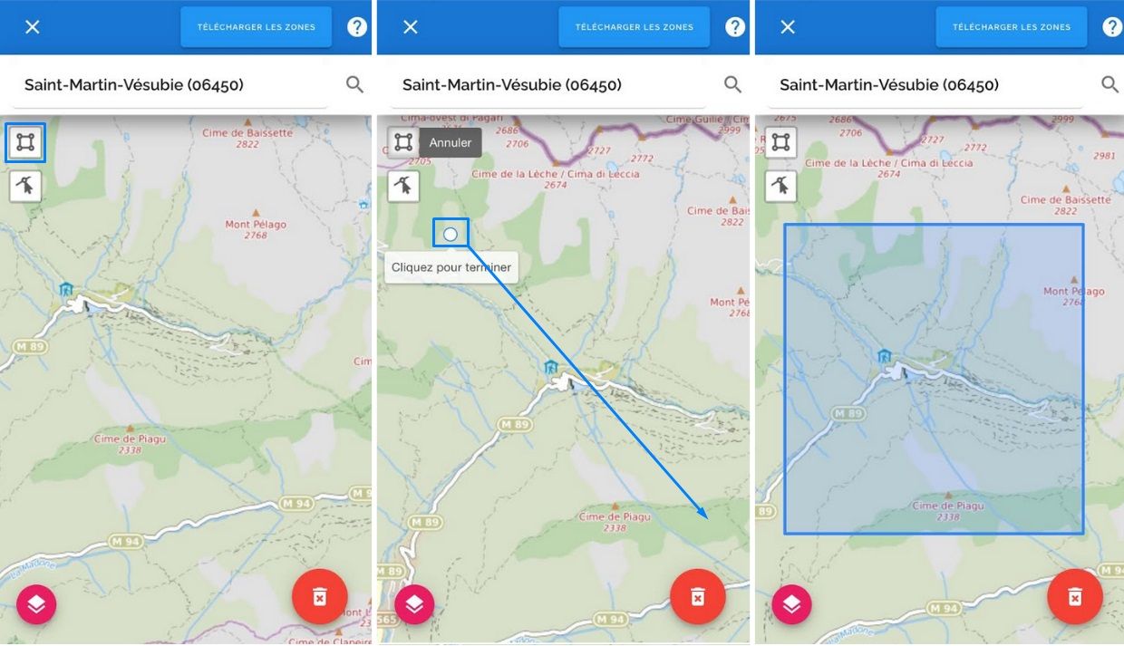
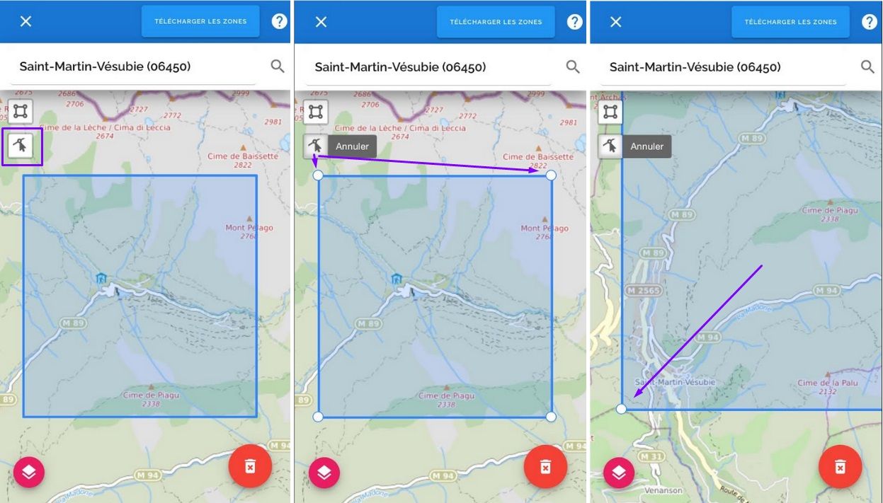
Click on the icon « create an area » displayed at the top left of the map. Draw your area's first point at the top left, around the place you want to visit. Then, put a point at the bottom right to draw a rectangle with those two points as opposite angles. Your map is now ready to be downloaded.
Reduce, widen and add another area
Gosh, I realize that my map is too small. I am going to extend a bit the defined area, to encompass the town of Saint-Martin-Vésubie.
To do this, click on the button of area modification, always situated on the top left of the map. The rectangle switches to the Editing mode, thereby you can move the points where you want.
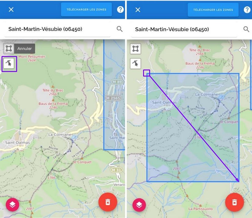
My area is wide enough, and I am going to add another rectangle in case if I would lengthen my outing at tha last minute: the Colmiane seems to be a nice place for hiking! I move the map heading north for a wild, and draw another rectangle there.
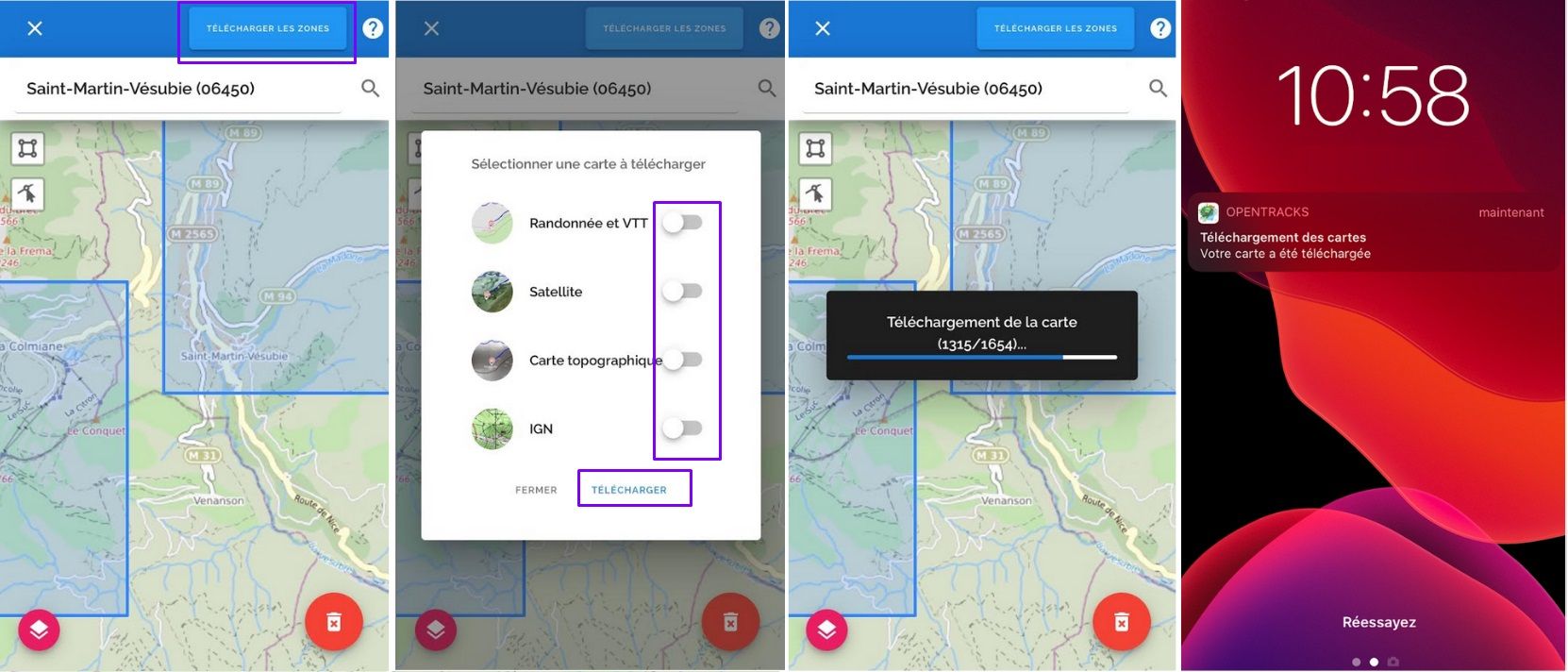
Once your selection is complete, export it by clicking "Download zones"!
Choose your downloading options
OpenTracks offers 4 basemaps:
- Hiking & Biking, this map give a lot of details concerning trails;
- Satellite, it gives a good overview of the area with real image;
- Topographic, ideal for seeing the elevation curves;
- (Soon) IGN, the best one in terms of elevation, mileage, useful or cultural information.
All are useful but I only choose two maps, I have to pay attention to the space memory taken up on my phone. I click on the “download” button: 1654 pieces of maps are necessary!
However, no worries, during the download and whatever the number of pieces of map required, let your phone go into sleep mode and the app will notify you when it is finished.
When your hiking, riding, trekking is done, remember to free up some memory on your phone, in expectation of your next outing: delete the maps in going back to this screen, and finally click on the “delete” button on the right bottom.
In conclusion
As you can see, the power of map’s downloading is within everyone's reach, it is up to you to develop it. Discovering and mapping a new area without a predefined route, it's the prerogative of savvy Trackers!
Florian from OpenTracks